Satellite Images Show Huge 'Permanent' Chinese Troop Expansion At Site Of India Border Clash
Even though by the start of this week India and China announced a cooling of tensions along the disputed Galwan Valley Line of Actual Control (LAC) border area, new satellite images have revealed a major military build-up especially by the Chinese side.
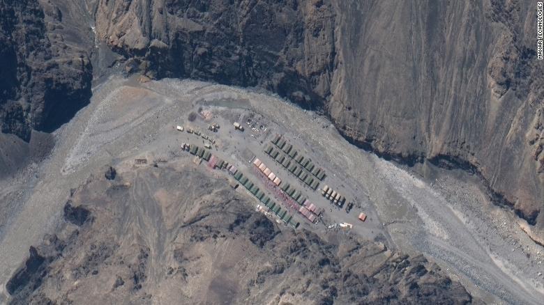
What was previously but a small, remote Chinese People's Liberation Army (PLA) outpost has grown huge in size after the June 15 nighttime clash which left 20 Indian soldiers said, many of them having fallen to their deaths during hand-to-hand combat from a precarious ridge line.
 Maxar Technologies/CNN
The satellite images produced by Maxar Technologies were taken Monday, reports CNN, and show that a week after the deadliest India-China border clash in half a century PLA forces had significantly expanded their encampment.
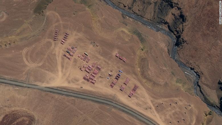
The PLA has reportedly stationed tank and artillery units in the contested border region.
It was a day later on Tuesday that Chinese Foreign Ministry spokesman Zhao Lijian announced that talks between the two sides' top regional commanders resulted in a positive breakthrough. They "agreed to take necessary measures to promote a cooling of the situation," Zhao said.
 Maxar Technologies/CNN
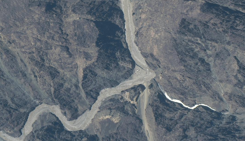
Below: Before image showing the relatively empty area of what's dubbed Patrol Point 14 in the Galwan Valley between May 22 and June 22 (compared to apparent build-up in same area shown above).
 Maxar Technologies/CNN
"The small outpost ... has grown hugely in size," the analyst at the Australian Strategic Policy Institute who first revealed the images, Nathan Ruser tweeted on Thursday.
"Indian troops aren't dismantling this one," he added, emphasizing that the new PLA expanded camp appears permanent.
Satellite imagery from the Galwan Valley on June 22nd shows that 'disengagement' really isn't the word that the government should be using. This gif shows the small outpost that sparked the June 15th clashes. It has grown hugely in size. Indian troops aren't dismantling this one. pic.twitter.com/8Q78ftr3uW
— Nathan Ruser (@Nrg8000) June 24, 2020
Though analysts say it's clearly a PLA encampment, Indian media reports claimed that the Indian Army was in full control of the disputed Galwan Valley area in question.
However, analysts say the new images refute those claims, as CNN reports:
The Maxar satellite photos released this week appear to show China has put a tank company and artillery units at a camp north of Gogra. Another significant base was shown in the Kongka Pass.
Ruser, in an analysis released before the latest satellite photos came out, said previous such photos showed Chinese troops have been regularly crossing the LAC on patrols into Indian territory -- although not at the point of the June 15 clash -- but that reports of thousands of Chinese troops encamped in Indian territory were unproven.
Analysts examining the new satellite photos further say that while the PLA presence has increased, the Indian Army appears to have drawn down from the immediate area of dispute.
China has reportedly moved about a thousand additional troops into the area after recent hostilities and spiking tensions.
Comments
Post a Comment